Blogpost
5.0 minute read
September 18, 2018
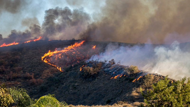
Known for its breathtaking vistas along the California coast, Big Sur draws more than 3 million visitors per year. But its redwood forests and magical beaches aren’t immune to the recent extreme weather events.
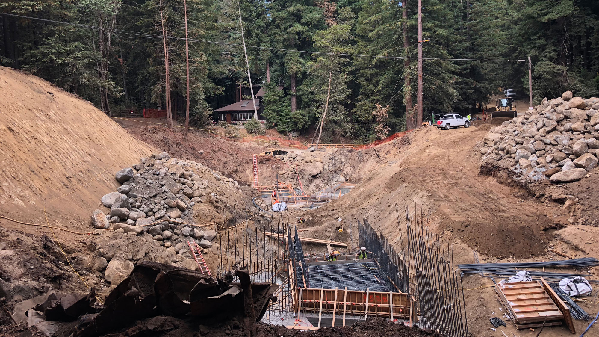
In 2016, Big Sur endured a several month-long forest fire, followed by record-breaking rains that sent sediment and debris raging through the narrow canyon. The floodwaters blew out two creek culverts and crumpled the roadway, rendering it inaccessible. Sixty homes were cut off from services, schools, and other necessities.
The project presented a myriad of challenges requiring deviation from business as usual.
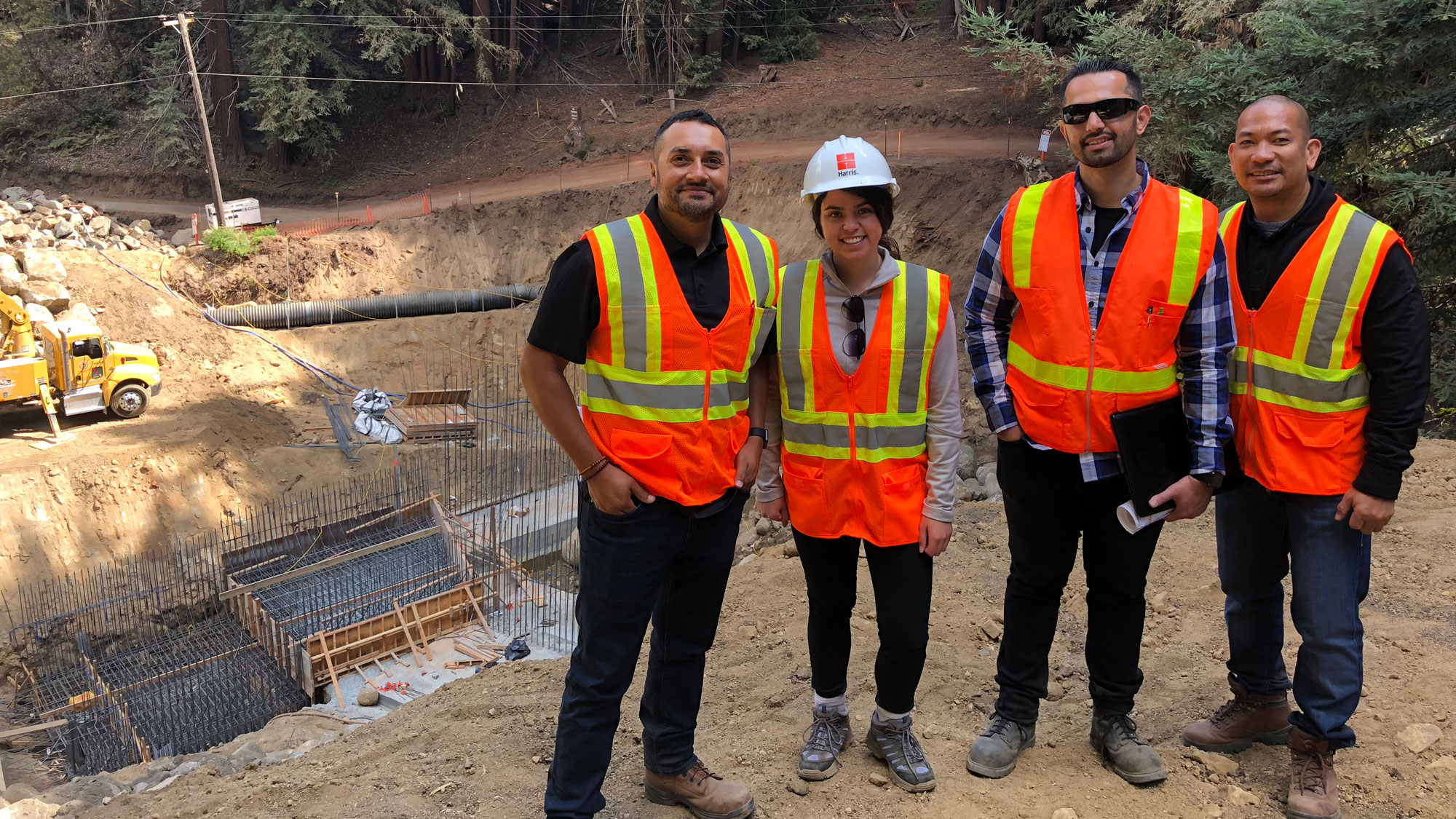
Monterey County Public Works had to act fast to restore community access and repair the road before the next rainy season. The County called on Harris & Associates for assistance with project management, environmental permitting, surveying, geotechnical assessment, preliminary design, community outreach, and final PS&E.
The project presented a myriad of challenges requiring deviation from business as usual. The design had to overcome environmental challenges and constraints. Communication and coordination were essential from the start, as this project had many moving parts and stakeholders. We learned some lessons along the way, informing our approach to future projects.
Environmental Challenges
It was bad enough that the damage occurred in a dense, remote redwood forest in a narrow canyon. But the substantial sediment and debris deposits obscured site conditions, burying Ordinary High Water Mark (OHWM) indicators. It was extremely difficult to define the limits of agency jurisdiction. Plus, Rocky Creek is a critical habitat for listed steelhead and California red-legged frogs, creating even more environmental obstacles.
There were many stakeholders and regulators in the mix: FEMA, Cal OES, U.S. Army Corps of Engineers, U.S. Fish and Wildlife Service, National Marine Fisheries Service, California Department of Fish and Game, Regional Water Quality Control Board, just to name a few. All these players made repairs complicated—especially when it came time to reaching a consensus. Not all parties agreed on the environmental baseline or the design solution.
However, we were as resourceful as possible. To overcome obscured site conditions, we relied on topographic survey data and 100-year flood elevation to determine certain limits and jurisdictions.
There were many stakeholders and regulators in the mix: FEMA, Cal OES, U.S. Army Corps of Engineers, U.S. Fish and Wildlife Service, National Marine Fisheries Service, California Department of Fish and Game, Regional Water Quality Control Board, just to name a few.
And from the start, Harris consulted the regulatory agencies to gather input and set priorities. We kept FEMA and Cal OES informed so they could understand the project’s evolution. Communication and coordination informed the project design and resolved differences to streamline necessary approvals.
Design Challenges
The County needed a permanent design solution that would provide reliable access, withstand future flood flows, meet regulatory agency requirements, and qualify for FEMA reimbursement.
From start to finish, Harris’ design engineers and environmental specialists collaborated on project design and coordinated with permitting agencies, FEMA, and Cal OES. But coordinating with FEMA was challenging, given the agency was dealing with several other disasters at the time and staff was continually changing.
We used an integrative approach with various considerations coming into play: constructability, permitting, and civil design. Harris ultimately presented three alternatives for the Rocky Creek crossing, and a metal arch culvert was selected.
Although it was the most feasible option acceptable to permitting agencies, the metal arch culvert came with its own set of challenges—mostly in terms of its large footprint and lack of onsite mitigation opportunities. Even so, the project successfully removed a fish passage barrier, installed a natural bottom arch culvert, and planted over 100 redwood trees both onsite and at a nearby Big Sur Land Trust redwood restoration site.
Schedule Challenges
Residents needed access to their homes as soon as possible, and the impending rainy season put even more pressure to finish work fast. Harris coordinated with the permitting agencies early to understand their concerns and get their buy-in on the design and mitigation measures.
However, coordinating with FEMA to obtain their buy-in on design proved more challenging due to staff deploying to other disasters and lost momentum during the Project Review stage.
Harris found the best way to engage all stakeholders was to hold a series of conference calls, leading to one pre-application site visit with all parties – including the permitting agencies and FEMA. And although approvals from FEMA took longer than expected, the County is providing the community with a permanent solution that provides more reliable access for the residents and the fish—all before sediment-filled storm water comes rushing down the canyon again.
The Ultimate Take Away? Collaboration, Coordination, and Communication
Thanks to collaboration between the design and environmental teams, early coordination with permitting agencies, and frequent communication between parties, the team will finish the project in early November – less than two years after the fire and flood. Although the Palo Colorado Road project was deemed an emergency on an expedited schedule, the “three Cs” can apply to any project.
For instance, design should include collaboration and coordination among engineers, environmental stakeholders, regulatory agencies, and FEMA. And on that note, it helps tremendously to understand the FEMA funding process, as well as FEMA’s obligations for emergencies across the country.
Start the process and reach out to the permitting agencies for technical input as early as possible. The wetland delineation should be verified up front as well, especially if there are obscured site conditions.
...design should include collaboration and coordination among engineers, environmental stakeholders, regulatory agencies, and FEMA.
Finally, frequent and inclusive communication is key. Talk early and often to all stakeholders, not only to gain early input, but to ensure that everyone is hearing the same thing, has an opportunity to weigh in, and a common understanding moving forward. This will keep your project moving forward, streamline the process, and save time and money.